![](/images/other/stat-length.png)
![Trail On foot Göpfritz an der Wild - Georgenberg - Watzelmühlen-Weg 42 - Photo](https://media.geolcdn.com/t/1900/400/9476b6e7-dd09-4a81-b295-4c53e6c55199.jpeg&format=pjpeg&maxdim=2)
Georgenberg - Watzelmühlen-Weg 42
SityTrail - itinéraires balisés pédestres
Tous les sentiers balisés d’Europe GUIDE+
![Length](/images/other/stat-length.png)
Length
20 km
![Max alt](https://static1.geolcdn.com/siteimages/upload/files/1508320355ic_sort_altitude_max_24dp.png)
Max alt
652 m
![Uphill gradient](https://static1.geolcdn.com/siteimages/upload/files/1508320355ic_sort_den_pos_24dp.png)
Uphill gradient
316 m
![Km-Effort](/images/other/stat-length.png)
Km-Effort
25 km
![Min alt](https://static1.geolcdn.com/siteimages/upload/files/1508320355ic_sort_altitude_min_24dp.png)
Min alt
500 m
![Downhill gradient](https://static1.geolcdn.com/siteimages/upload/files/1508320355ic_sort_den_neg_24dp.png)
Downhill gradient
313 m
![Boucle](https://static1.geolcdn.com/siteimages/upload/files/16400158638029165_repeat_loop_refresh_sync_direction_icon.png)
Boucle
Yes
Signpost
Creation date :
2022-02-16 17:28:46.233
Updated on :
2022-03-03 20:58:33.447
![On foot](https://static1.geolcdn.com/sitytour/trail-icons/100.png)
5h35
Difficulty : Medium
![Scan this QR Code to open this trail in the SityTrail application](https://capi.geolives.com/qq0zvz2zws4bq2lad0pu/sitytour/trails/3129750/qr.png?size=200)
FREE GPS app for hiking
About
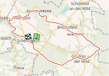
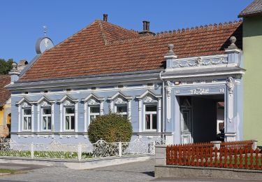
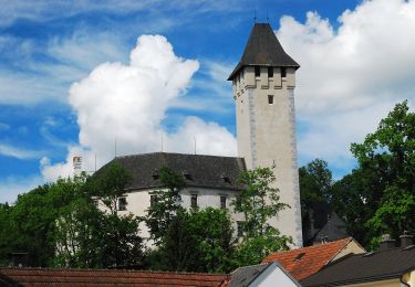
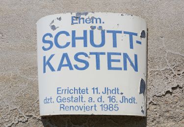
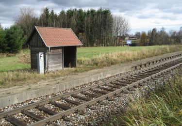
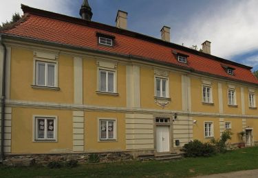
Trail On foot of 20 km to be discovered at Lower Austria, Bezirk Zwettl, Göpfritz an der Wild. This trail is proposed by SityTrail - itinéraires balisés pédestres.
Description
Symbol: 42 au gelbem Grund
Positioning
Country:
Austria
Region :
Lower Austria
Department/Province :
Bezirk Zwettl
Municipality :
Göpfritz an der Wild
Location:
Unknown
Start:(Dec)
Start:(UTM)
525545 ; 5398149 (33U) N.
Comments
Trails nearby
![Trail On foot Göpfritz an der Wild - Kräuterweg 43 - Photo](https://media.geolcdn.com/t/375/260/8c218c0d-d51f-4186-a6e8-11eb7b8a42b8.jpeg&format=jpg&maxdim=2)
![On foot On foot](https://static1.geolcdn.com/sitytour/trail-icons/100.png)
Kräuterweg 43
On foot
Easy
Göpfritz an der Wild,
Lower Austria,
Bezirk Zwettl,
Austria
![](/images/other/stat-length.png)
4.7 km | 5.3 km-effort
1h 11min
![](https://static1.geolcdn.com/siteimages/upload/files/16400158638029165_repeat_loop_refresh_sync_direction_icon.png)
Yes
![Trail On foot Göpfritz an der Wild - Bergteichweg 41 - Photo](https://media.geolcdn.com/t/375/260/4898cee2-4b24-4a58-9b9c-3a771e499082.jpeg&format=jpg&maxdim=2)
![On foot On foot](https://static1.geolcdn.com/sitytour/trail-icons/100.png)
Bergteichweg 41
On foot
Easy
Göpfritz an der Wild,
Lower Austria,
Bezirk Zwettl,
Austria
![](/images/other/stat-length.png)
14.9 km | 16.7 km-effort
3h 47min
![](https://static1.geolcdn.com/siteimages/upload/files/16400158638029165_repeat_loop_refresh_sync_direction_icon.png)
Yes
![Trail On foot Göpfritz an der Wild - Dreipfarren - Wanderweg 40 - Photo](https://media.geolcdn.com/t/375/260/86d4a6e4-eca1-4073-bcb4-637b4f197c2b.jpeg&format=jpg&maxdim=2)
![On foot On foot](https://static1.geolcdn.com/sitytour/trail-icons/100.png)
Dreipfarren - Wanderweg 40
On foot
Easy
Göpfritz an der Wild,
Lower Austria,
Bezirk Zwettl,
Austria
![](/images/other/stat-length.png)
4.5 km | 5.2 km-effort
1h 10min
![](https://static1.geolcdn.com/siteimages/upload/files/16400158638029165_repeat_loop_refresh_sync_direction_icon.png)
No
![Trail On foot Allentsteig - Natur 33 - Photo](https://media.geolcdn.com/t/375/260/c1c00b55-4454-4bed-9af6-2461481ef678.jpeg&format=jpg&maxdim=2)
![On foot On foot](https://static1.geolcdn.com/sitytour/trail-icons/100.png)
Natur 33
On foot
Easy
Allentsteig,
Lower Austria,
Bezirk Zwettl,
Austria
![](/images/other/stat-length.png)
9.8 km | 11.8 km-effort
2h 41min
![](https://static1.geolcdn.com/siteimages/upload/files/16400158638029165_repeat_loop_refresh_sync_direction_icon.png)
No
![Trail On foot Allentsteig - Bundesheer - Photo](https://media.geolcdn.com/t/375/260/53deee7e-57c6-4d02-a483-e46bd2e8146a.jpeg&format=jpg&maxdim=2)
![On foot On foot](https://static1.geolcdn.com/sitytour/trail-icons/100.png)
Bundesheer
On foot
Easy
Allentsteig,
Lower Austria,
Bezirk Zwettl,
Austria
![](/images/other/stat-length.png)
8.5 km | 10.1 km-effort
2h 18min
![](https://static1.geolcdn.com/siteimages/upload/files/16400158638029165_repeat_loop_refresh_sync_direction_icon.png)
Yes
![Trail On foot Allentsteig - Eichen und Eulen 30 - Photo](https://media.geolcdn.com/t/375/260/30ec026a-5073-4092-8174-1a4d12505f9d.jpeg&format=jpg&maxdim=2)
![On foot On foot](https://static1.geolcdn.com/sitytour/trail-icons/100.png)
Eichen und Eulen 30
On foot
Easy
Allentsteig,
Lower Austria,
Bezirk Zwettl,
Austria
![](/images/other/stat-length.png)
6 km | 7 km-effort
1h 35min
![](https://static1.geolcdn.com/siteimages/upload/files/16400158638029165_repeat_loop_refresh_sync_direction_icon.png)
No
![Trail On foot Schwarzenau - Von den Fuchshöhlen bis zur Wolfsgrube - Photo](https://media.geolcdn.com/t/375/260/a0e30655-4c4a-4ab0-8107-5e232157c7f1.jpeg&format=jpg&maxdim=2)
![On foot On foot](https://static1.geolcdn.com/sitytour/trail-icons/100.png)
Von den Fuchshöhlen bis zur Wolfsgrube
On foot
Easy
Schwarzenau,
Lower Austria,
Bezirk Zwettl,
Austria
![](/images/other/stat-length.png)
8.8 km | 10.5 km-effort
2h 23min
![](https://static1.geolcdn.com/siteimages/upload/files/16400158638029165_repeat_loop_refresh_sync_direction_icon.png)
Yes
![Trail On foot Schwarzenau - Alter Schwede 12 - Photo](https://media.geolcdn.com/t/375/260/b84a1f8f-26e1-483e-8273-7157d4c9aeb6.jpeg&format=jpg&maxdim=2)
![On foot On foot](https://static1.geolcdn.com/sitytour/trail-icons/100.png)
Alter Schwede 12
On foot
Easy
Schwarzenau,
Lower Austria,
Bezirk Zwettl,
Austria
![](/images/other/stat-length.png)
9.3 km | 10.7 km-effort
2h 26min
![](https://static1.geolcdn.com/siteimages/upload/files/16400158638029165_repeat_loop_refresh_sync_direction_icon.png)
No